POSTS
Using Wordpress, Twitter, GPS to document a multi-day hike in Spain
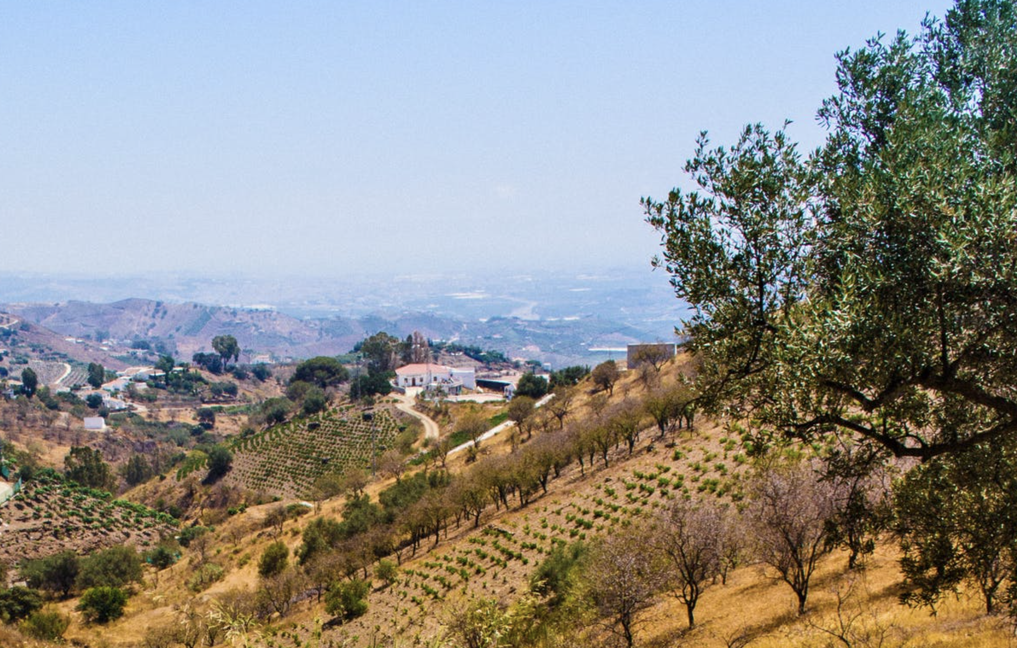
In 2016, I did a hiking expedition, named Bajada, in Spain starting in the Sierra Los Velez national park, walking a dried up watercourse and finishing at the coast at Mazarrón. It was part of a project themed on water for the Joya Arte e Ecología organisation.
I wanted to share the journey on social media, a website and live from the field.
How?
I decided to do this through the following strategies:
- A website built on WordPress with a customised theme
- A plugin that shows a map with a location pin
- A mobile phone with a GPS signal and a 3G internet connection
- Tweeting on Twitter with the location and an image
- Showing tweets on a map with Google Maps JavaScript API
- A Garmin GPS unit to keep a track log and as a backup
GPS and Twitter
I carried a Garmin GPS unit with me to record a track log and to make a backup GPX of the route. I turned on location recording on my Twitter account so that the tweets I posted had a latitude and longitude attached to them. I also posted an image with the Tweet which meant the image would have location information attached to it.
Charging the Batteries
I needed to make sure that I had a solution for charging AA batteries for the GPS unit and for charging my mobile phone. I charged both of these devices via a solar panel.
The Mobile Phone Used
The mobile phone used was an iPhone 5. There are better phones now with a longer battery lives but at the time this did the job. The performance of the battery also makes a difference as older, worn out batteries can be much worse at holding their charge. It is possible to change the battery in some phones. (edit - I did this later on with my iPhone).
The GPS unit used
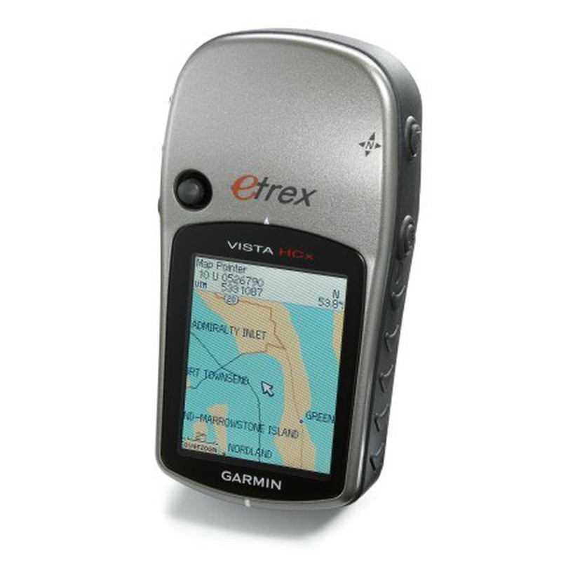
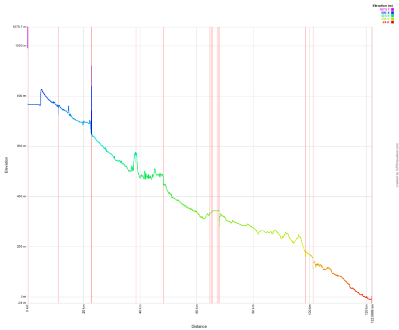
The Garmin unit that was used was an Etrex Vista HCX which I had lying around from previous journeys. Detailed maps can be loaded onto it. These days you can also load detail Maps onto a mobile phone, but it helps to have separation of concerns between devices in case one fails. The GPS unit also recorded detailed altitude and other information that I could upload onto a website called GPS visualizer (GPX file).
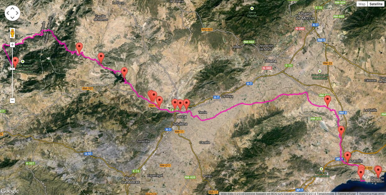
GPS visualizer, Google Maps JavaScript API and Waypoints
Once I had completed the journey, I wanted to communicate it. One-way was through a map with a waypoint marker shown on each blog post on my WordPress site.
I used the GPS Visualizer website to show the track log on a Google Map and a graph of altitude information. Finally, I created a Google Map which showed waymarkers for each tweet, with a pop-up window showing the photo and the text from the tweet.
The area which required the highest technical knowledge was using the JavaScript Google Maps API to show the way markers and the pop-up windows on a Google map. I followed some tutorials, and it wasn’t too bad.
Pros
- Effective method of documenting my journey
- Connected my journey to a wider audience via Twitter
Cons
- Loss of internet connection in some remote areas
- High level of technical ability (coding) needed for some of the pieces
- Time to prepare and execute
Conclusion
It would be helpful to have someone else coordinate the technical side during the expedition. If there is a technical issue then its impossible to fix it from the field by yourself without interrupting the journey. There is also a cost for hosting a WordPress website so you should take this into account. (edit - A more effective method could be to use social media directly, as in post using Instagram, as you would potentially reach a wider audience with less effort. However, you wouldn’t fully own your content and the solution is possible less flexible depending on what you want to create.)